January 3, 2025
360 Drone Mapping: A Revolutionary Approach to Volumetric Cut & Fill Analysis
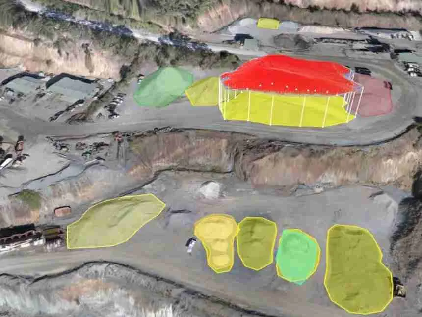
In the world of construction, land development, and environmental engineering, accurate and reliable data is essential. One of the most important tasks in these fields is volumetric cut and fill analysis, a process that helps determine the amount of earth material to be moved in order to prepare a site for construction or development. Traditionally,…