GCPs are the clearly marked points on the ground whose GPS coordinates are known. Aerial images are aligned during processing with the help of surveyors. Essentially, they serve as anchors for your data; therefore, GCPs ensure that the models you generate are accurate. Without GCPs, your results will probably shift or misalign. Using GCPs will help create maps with a truly reliable measurement. They are indispensable in the aerial stuff and photogrammetry scene. The placement of GCP enhances the credibility and quality of surveys.
The Role of GCPs in Aerial Mapping
GCPs link your drone images to real-world coordinates. They are supposed to fix the errors made based on the altitude, terrain, or camera angle. There tend to be slight shifts in any aerial data collected without GCPs, which will affect your final measurements and models. The introduction of GCPs locks the imagery into the correct position, much like snapping puzzle pieces into place. The outcome can be trusted if the Good Clinical Practices (GCPs) are followed correctly. It is very crucial in construction, mining, and agriculture.
How to Choose GCP Locations
The placement of GCPs should be a deliberate decision, not an impromptu measure. Select sites that are free from obstructions and located on open, flat terrain when placing GCPs. Make sure shadows, slopes, and reflective surfaces don’t flow in your GCP locations. Spread them out evenly in the survey area. Important GCP locations are the corners and the center of your survey field. Normally, you should set five to ten GCPs depending on the size of your site. Even the distribution of GCPs facilitates consistent adjustments of the software on images in the survey area. This helps to generate more reliable and evenly distributed results.
Marking and Measuring GCPs Correctly
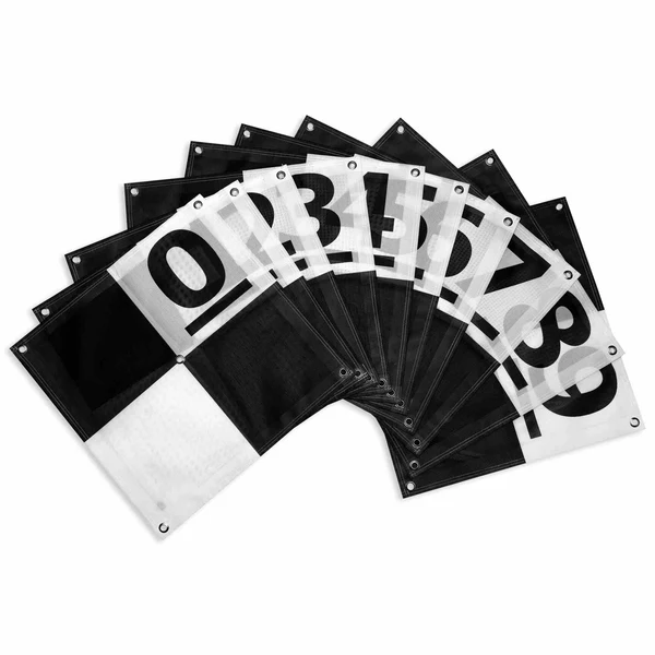
Select unique targets that can be easily seen to install GCPs. White and black checkerboard patterns are popular due to their optimal visibility. Other surveyors would use coated targets or heavy mats to clearly identify the target. After installing the targets, measure their size using a GPS. RTK or PPK methods are the most accurate for your coordinate measurements. Ensure that all readings were taken correctly before proceeding to measure additional points. A minor measurement error can affect the model as a whole. Proper placement is indispensable, and accurate coordinates are equally important.
How Many GCPs Do You Really Need?
The requirement depends on the width of the project you want to work on. On small sites, five control points are sufficient. In a large or complicated site, more GCPs should be included. When mapping far distances, place extra control points regularly throughout the way. By setting GCP at various locations, you ensure better accuracy throughout the site. More GCPs typically mean a better quality of your model. However, having more GCPs takes more time, so use them wisely. Determine the optimal number of GCPs, considering the project’s timeframe and unique requirements.
Common Mistakes to Avoid
Do not put GCPs over obstructions such as trees or buildings. They stop the camera from allowing it to see into your area of interest from above. Make sure you keep a distance between the markers—place markers at places where people rarely pass by. People or vehicles may come to disturb or conceal the markers. Ensure that your GCPs are identifiable in the aerial pictures that you take. Failure to sample a Good Clinical Practice (GCP) guarantees that your results are not reliable and cannot be used. Review your images to identify all issues before processing begins.
Ground Control Points vs. RTK Drones
Some RTK drones provide constant updates to their GPS information. A myth that exists is that the use of RTK eliminates the need for a Ground Control Point. In most instances, GCPs are a must-have. The RTK drone positioning can get unreliable when the satellites have disruptions or interference. GCPs validate the correct placement of drones, adding further reliability to your model. Using GCPs combined with RTK technology yields the best quality results. Through GCPs, there is the last guarantee that your model is geographically accurate. Visualize the wooden boxes as a credible check and assurance of the accuracy of your data.
Why Proper Placement Matters Every Time
Professional drones aren’t enough if Ground Control Points (GCPs) aren’t used properly. Proper consideration of GCP placement today will make the job easier and yield better results. It saves your time in post-production and results in a superior end product. Your results will be tailored to each client. It helps you gain the confidence and appreciation from others in your work. In effect, the end quality of your product will depend on how well you have installed your GCPs.
Conclusion: GCPs Make Accuracy Possible
Accuracy is what you want, whether you’re mapping land or stockpiles. Using Ground Control Points, you can perfectly fix your results at that level of precision. Accessibility explanation: Proper placement of GCPs shortens the process, creates trust, and maximizes the accuracy of your work. That’s how you take your mapping outputs from just decent to phenomenal.